Goal: To quickly teach the basics of AutoCAD to allow landscape designers to create fast, accurate landscape plans.
Method: The class will be broken up into lessons. Each lesson will focus on creating a specific part of the landscape design. In this way you will be introduced to a few tools and commands at a time, and you will be able to practice using these tools to create a plan drawing. Each lesson that follows will build upon the previous lesson. At the end of the class, you will be able to create your own landscape plans using AutoCAD.
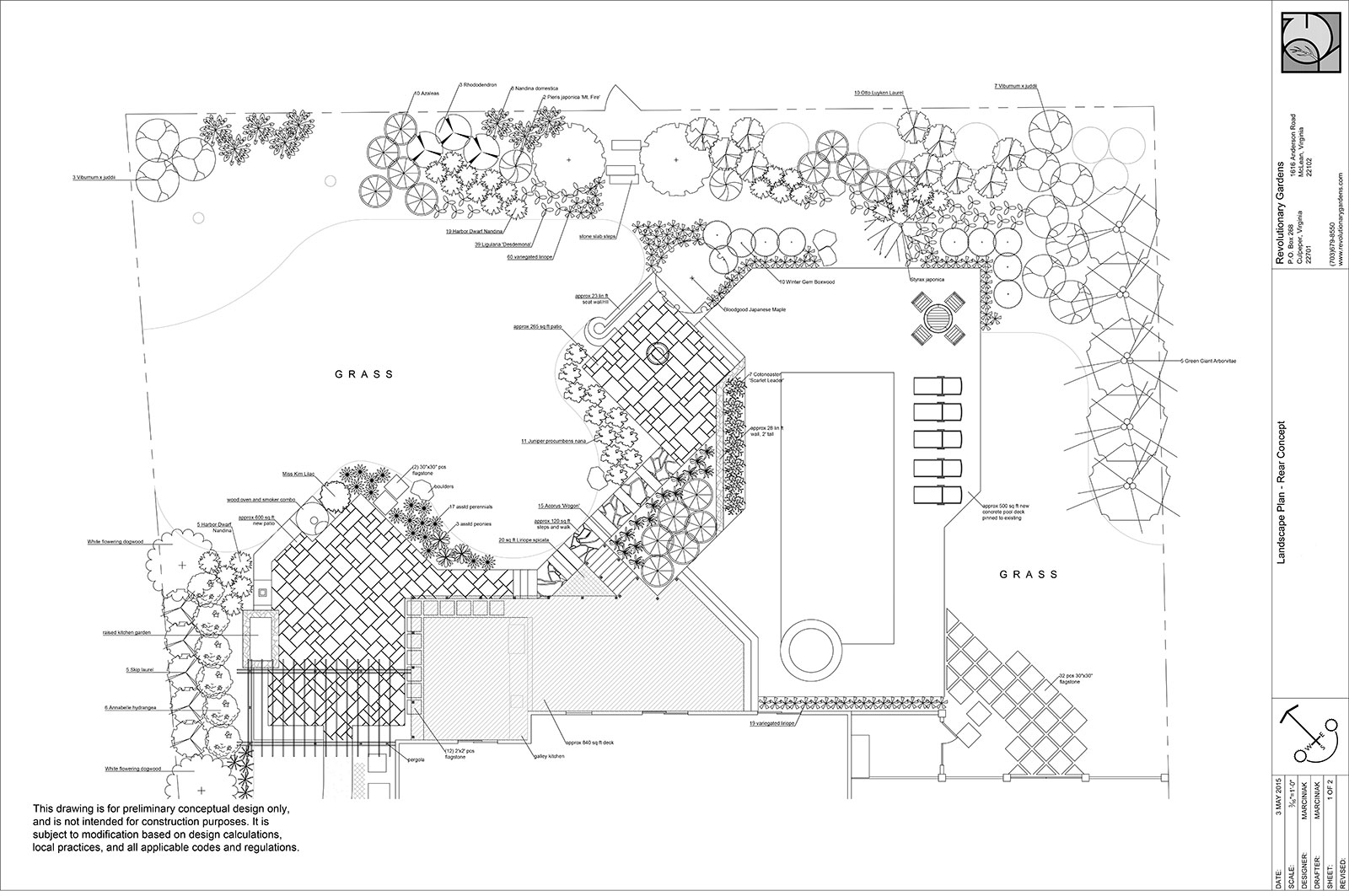
Software: I use AutoCAD LT because I don’t see the need for the full version of AutoCAD for landscape design. You can use either version, just know that if you don’t use AutoCAD LT your workspace will look slightly different from mine.
AutoCAD for landscape designers: Lesson overview
Lesson One: Getting Started
At its core, AutoCAD is just an electronic drafting table. We’ll start by reviewing some of the basics of hand drafting so you can see how these techniques are replicated in the AutoCAD environment.
We will then look at the AutoCAD workspace to see how the tools and functions are laid out and accesses.
Lesson Two: Measuring the site
Wait, isn’t this an AutoCAD class? Well, the way I measure a site is tailored to how I enter the site data in AutoCAD. Lesson two will show you what I measure and how I record it so entering it all is quick and easy.
Lesson Three: Creating the basemap
In this lesson, we will use a sample project to learn how to start converting our site measurements into an AutoCAD basemap. You will learn how to:
- Draw the house, including windows and doors
- Draw the driveway and walkway
- Draw accurately located trees and other features
We will also review how to use layers to organize our drawings.
Lesson Four: Designing the hardscape
Lesson four is where we start using AutoCAD for the creative part. We will create a new front walkway, using AutoCAD’s tools to create accurate linework and smooth curves. We’ll learn how to label and dimension our drawings and how to pull accurate square footages for estimating. And I’ll show you how easy it is to use AutoCAD to create layout drawings for installation crews.
Lesson Five: Adding plants!
It isn’t landscape design without plants! I’ll show you a couple of different ways of representing different plants in your drawing, and how to document plant sizes and quantities.
Lesson Six: Customizing and printing
Your drawings should always have your company info on the titleblock as well as details about the client’s project. In lesson six we’ll create your titleblock, format your drawings for print, and walk through printing (or saving as a PDF).
Lesson Seven: Attaching raster images
AutoCAD allows you to quickly and easily import images, scale them, and trace over them. This can be a quick and easy way to create a basemap off a survey or even a screenshot from a GIS website. It’s also a great way to add detail drawings to your plans.
Lesson Eight: Customizing AutoCAD for your business
We’ll go more in depth on topics like layer management, text styles, and creating block libraries to streamline your workflow.
And that’s it! There are more advanced ways to use AutoCAD but the goal for this course is to get you up and running and creating fast, accurate landscape plans. By the end of the final lesson you’ll be ready to make the switch from hand drafting (or a different software) to AutoCAD.
This class launches in April 2025. Please fill out the form below to be notified as soon as it is available for purchase!